....................MacGregor Index Page.......... 2015 Bahama Trip Index Page
....................................Previous Page......................................Next Page If There Is One
=========================================================
|
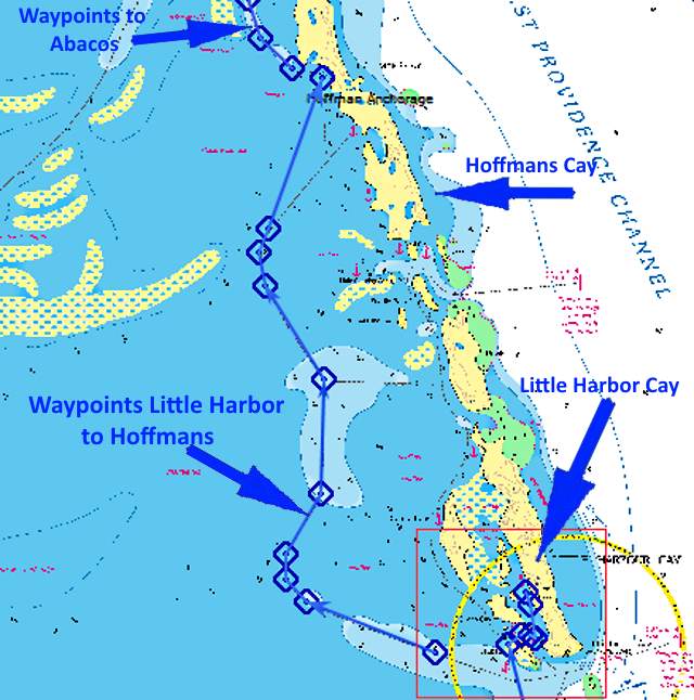
..............................--- Little Harbor Cay ---................................ ..........................................................--- To --- ......................................--- Hoffmans Cay ---
|
.....................................................................................................
===============================================
|
.............................................................(May 18th) Anchorage --- N 25º 38.073´ ==== Trip Mileage = 974 miles .7................W 77º 44.816´ ==== Day's Mileage = 8 miles |
===============================================
Up early to listen to Chris, but went to bed fairly early also. Winds for the day were suppose to be E at 16-18 with gusts into the 20's but the next day it was suppose to settle with winds down to 10-15 and clocking from E to maybe ESE. I decided to wait so ate breakfast and looked at my options on OpenCPN for about the hundredth time.
If you are going out of Little Harbor through the cut and due east into Northwest Providence Channel there is a reef and you can go either to the north of it or the south. The south looked wider and deeper so felt maybe the current wouldn't be as bad if I wanted to go out before slack with the incoming tide still running. I called Chester on the radio to see if he could give me some info. He said they were about the same. By now it was after 9 am. I finally made a snap decision, not sure you could call it that since I'd thought about this for several days. I decided I'd go further north inside up to Hoffmans Cay. Kind of a mixed plan. It was blowing and I didn't want to get to Market Fish Cay, the very last cay north, and find a lot of surge there. I wanted a good night's sleep before the crossing over the deep, open water of Northwest Providence Sound so decided staying a couple miles south in a well protected bay was the ticket.
The only problem with the new plan was that the tide had been going out and I needed to do things quick before I got trapped in Little Harbor with lower water levels. I loaded the new route from OpenCPN to the handheld and put it out in the cockpit along with the portable VHF, binoculars and camera. Pull the pop-top cover off and stored it below and lowered the pop-top. Lowered the outboard and the rudder and made sure the centerboard was still up. Turned on the depthfinder in the cockpit and VHF radio below for the AIS targets. Move the computer monitor to the upper mount postilion and swung it around to the companionway where I'd be able to see it from the cockpit.
About ready so started the outboard and left it idling in neutral and put my gloves on and went forward. I had two anchors down and the current had the boat swung more onto the Manson so released that line some and started to pull the boat back to the claw anchor and got it up and then pulled into the wind up to the Manson and pulled it up. Made sure I had the chains wrapped around the cleats there and the lines with carabiners on them attached to the chains as an added safety feature to make sure all of this didn't go over the side underway.
Before the boat had drifted more than 20 feet at the most I was back in the cockpit and had the outboard in forward and was underway. I stayed a little more towards the Little Harbor shore going out than I had coming in but still kicked the rudder at the low spot in the channel. I left it up and just steered with the outboard for a couple hundred feet until I started seeing the numbers on the depthfinder starting to go up, showing deeper water. Reset the rudder and continued down to where I had to turn to the west and go through the narrow channel there.
The current was running there and swells were now coming in from the Sound. I increased the outboard for more speed so I'd have better rudder response. Just ahead hiding behind the small cay there was a German registered cat. I passed close by and just past it put the Genoa out and turned the outboard off. I left it in the water as....
.... the route had some twists and turns in it and I didn't want to get over confident about this sailing stuff and get myself and the boat into a bind.
The wind was every bit of 15-18 kts and gusting higher so I wasn't going to complicate things by trying to also put up the main but a little later that hurt me but still I was satisfied running on the Genoa as I can stow it in seconds and I was running over 4 for a lot of this and over 5 when I was broad reaching and not running but due to the route changes did both along with finally having to tack into the wind on the final leg.
I had to do one tack to get into position to sail into the small bay where I was planning on anchoring. I had been tacking using the tiller pilot but disengaged it and found out I could point higher hand steering as I could drop off if the sails started to luff. The tiller pilot couldn't sense that of course. Doing that I was able on the next tack to just clear the shallow water off the point on the south side of the bay and sail onto my anchorage and stopping the boat by turning into the wind at the point I wanted to drop anchor. I left the mainsheet slack so the main would luff and went forward and dropped the Manson and drifted back on it and was anchored. Then dropped the main into the sailpack. It was a nice feeling getting the hang of sailing along with sailing onto the night's anchorage. At this point I'd sailed about the entire 174 miles from Black Point in the Exumas to here with the exception of a few miles getting on or off anchor or through some cuts.
Once anchored I put the outboard on the dinghy and went ashore and walked the nice little sandy beach there ....
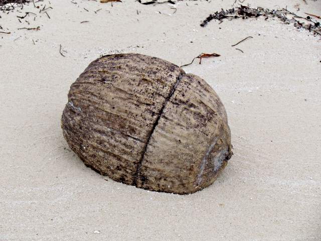
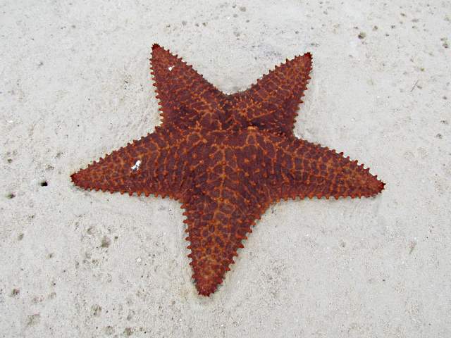
.... and enjoyed some of the sea and shore life that was washed up.
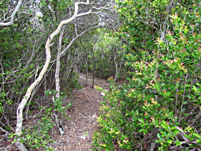
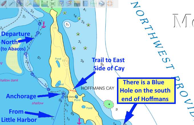
At the south end of the beach I noticed a trail going east through the underbrush and decided to take it.
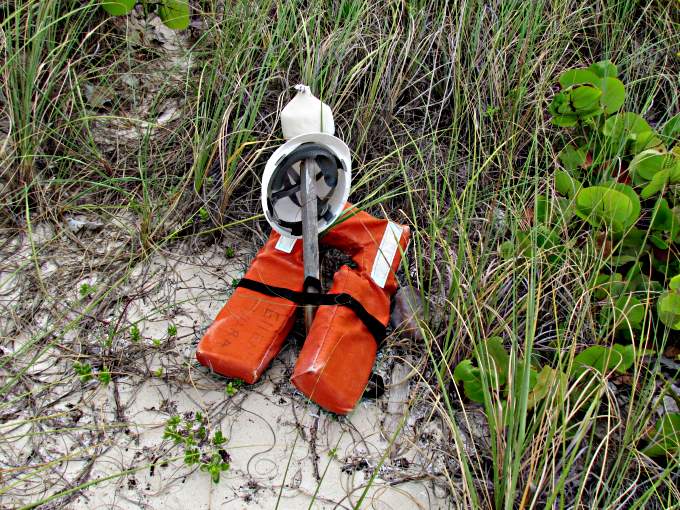
I found out that it took one over to the east side of the cay and over there someone had used items that had washed up to mark where it was. That helped when it came time to find it upon returning to the west side.
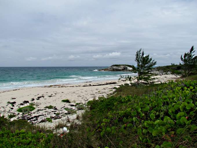
This side had long sandy beaches ...
... broken up with rock outcroppings that had not been pounded into sand by the ocean.
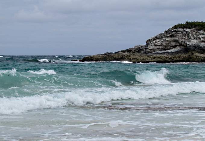
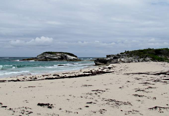
As is the case with a lot of the islands/cays the west side, that is exposed to the open ocean, has a much larger surf than the west side of the cays, where the water is much shallower and where the prevailing easterlies have been tamed by the island's mass. It seemed lonely and cold over on this side looking out onto the waters of the NW Providence Channel.
Looking out on the turbulent seas I was glad that I hadn't gone out of the cut at Little Harbor and attempted the Channel crossing today. The winds were suppose to subside some the next day so hopefully I'd have a safe and pleasant crossing to the lower side of the Abacos.
I returned to the boat and had a simple dinner and was off to bed. Tomorrow would be a long day.
=========================================================
........................................................................................Next Page If There Is One...